Kazakhstan is a vast country with an equally vast amount of things to see and do. Kazakhstan is actually the world’s largest landlocked country and the ninth largest overall. Despite all of this, Kazakhstan doesn’t receive many visitors, particularly from western tourists. We spent just under 3 weeks in Kazakhstan and had a great time. Of course, it would have been impossible to see much of the country in that time, so our recommendations in this article will be focused around the Almaty region. Kazakhstan’s other regions have a lot to offer as well, but a combination of the landscape and transport links make Almaty the obvious place to start.
Guidebook
Kazakhstan, particularly the Almaty region, has a great climbing guidebook, thanks to the hard work of local guide and route developer Kirill Belotserkovskiy. The guide has topos, descriptions and everything you need to find the crags easily. This is written only in Russian, however we used the Google translate ‘Photo’ feature to translate it into English which works perfectly. You can find the full here.
Kirill has translated some of the guidebook to English, and the section covering Tamgaly-Tas can be found in English on his website.
Climbing recommendations
Tamgaly-Tas
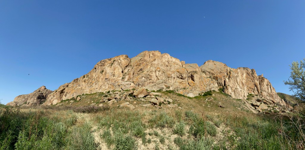
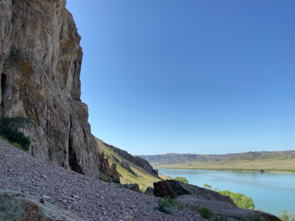
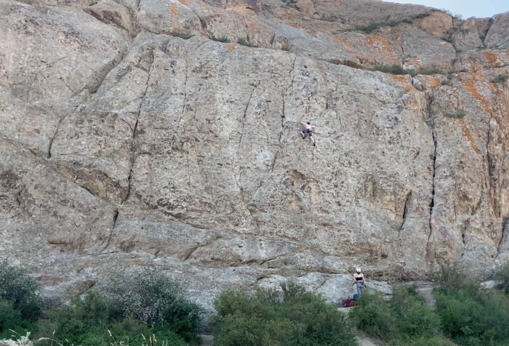
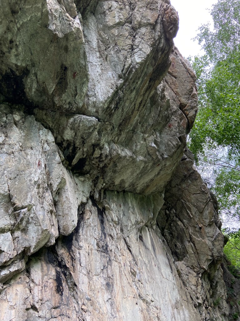
Tamgaly-Tas is set in a beautiful valley, with around 130 routes ranging from 5a to 8a+, set less than 50 meters from a lovely big river, perfect for swimming. Tamgaly-Tas is 115 km north of Almaty and the drive to get there is interesting in its own right. After leaving the city and passing the Kapshagay reservoir, the road enters the seemingly endless plains that lead right across Kazakhstan. It doesn’t feel like you’re heading to a crag at all. You turn off the paved road on to a series of sandy dirt roads that lead to the climbing. Choose which track you use carefully and don’t follow google maps! Driving a bit further on the main road and turning off at a small red sign for Tamgaly-Tas is the best route for 2WD cars.

There are several sectors dotted around the area, but the main crag is essentially a fin of rock with an east face and a west face, so you can follow the sun or shade during the day. The rock is a type of Tuff, which varies in quality. In general the rock was solid and the routes were well cleaned, however you will encounter some crumbly rock so a helmet is recommended for the belayer. The routes are mostly equipped with modern and well placed bolts.
The area is a tourist attraction in its own right, because of some impressive Buddhist petroglyphs (not to be confused with Tamgaly Petroglyphs, which are over 250 km away!). Because of this there is an entrance fee of 500 Tenge (€1) per person to enter the area. This is the case throughout Kazakhstan, most national parks or natural attractions have a similar fee to enter. This is always worth it, just be sure to carry plenty of small notes around with you.
The true origin of the petroglyphs is unknown, but the legend is that they were carved by buddhist missionaries after an earthquake caused some huge blocks to fall off the crag. They were thankful to have survived and left the petroglyphs as a sign of their gratitude.

We write for pleasure and climbing is our passion. Our articles will never be paywalled. However, if you would like to help towards the costs of running the site or if you have found our content useful, please consider contributing here. To read more about why your support matters, click here.
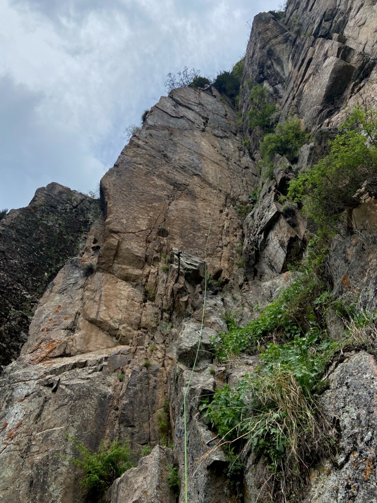
Tuyuk-Su
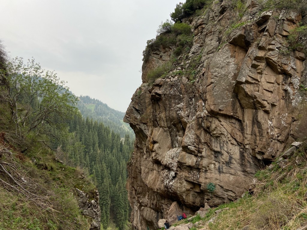
Tuyuk-Su is one of Kazakhstan’s best known and well developed climbing areas. There are over 30 routes here and around half of those are multi pitch. The grades range from 5b to 7c, with some of the hardest pieces of climbing on the multi pitch routes. The rock is granite and although most routes here are bolted, there are many opportunities for trad climbing. One thing to bear in mind with Tuyuk-Su is the weather. It is a true mountain area and can still be remarkably cold and wet in late spring. Bring your jacket and have a plan B in case of bad weather!
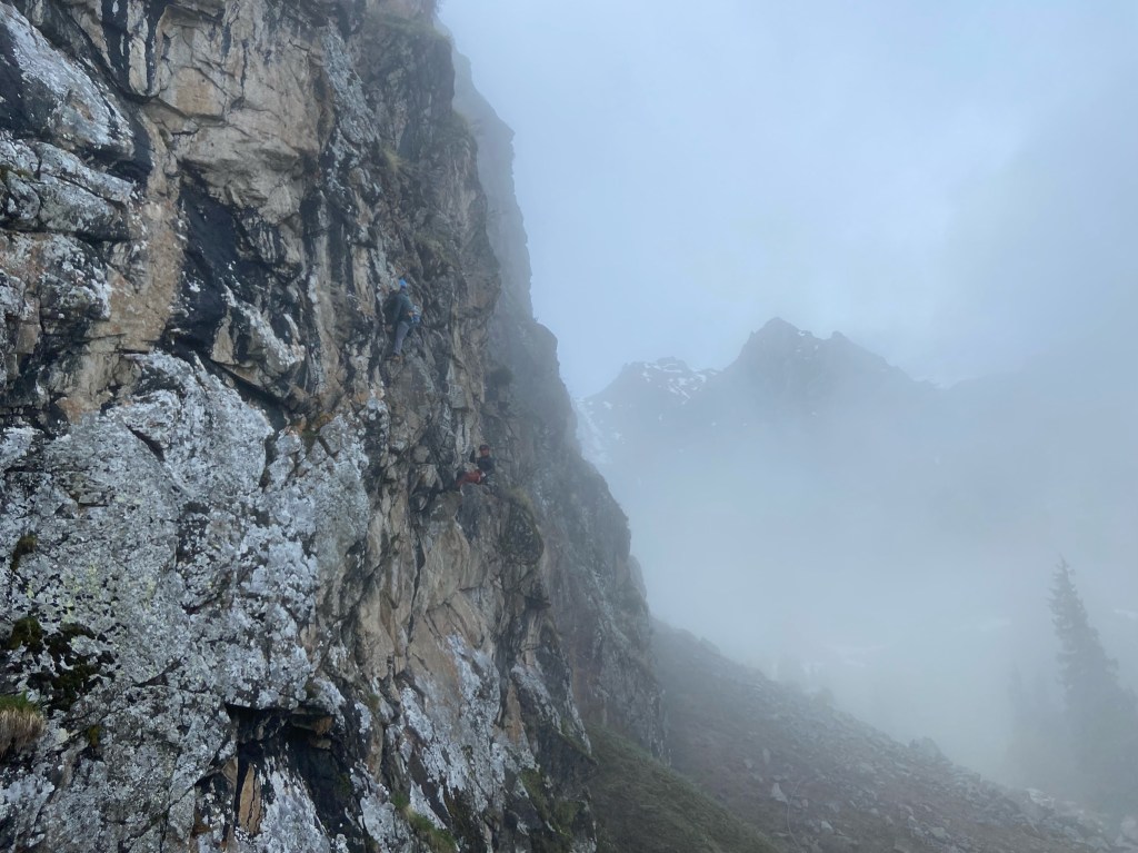
Fortunately the crags are located in an area that has fantastic hiking as well as lots of mountaineering. Anyone who enjoys spending time outdoors will be happy here. Another factor with Tuyuk-Su is the logistics of getting there. Using the cable car or mini bus daily can be time consuming and the costs will add up. As with most places it is possible to camp and Tuyuk-Su also has a campsite with facilities for those seeking some extra comfort. Going up from Medeo everyday is very feasible, and is a good option when the weather is less stable as you are more flexible to change plans. In the more reliable summer months going up for several days climbing and camping is the best option.

Medeo
Medeo is a small village located just on the outskirts of Almaty city, famous for an ice rink that is reportedly the highest in the world at 1,691 meters. It is easily reached by bus and there are many tourists visiting everyday. From Medeo, you can usually take the cable car up to the village of Shymbulak which in winter is a ski resort. The alternative is a boring walk, a shuttle bus or an electric taxi (cars aren’t permitted to enter the road up to the village). Shymbulak is where you begin the approach to Tuyuk-Su as well as the hiking beyond.
There are several small and easily accessible crags near the village of Medeo. These are essentially just small outcrops with around 24 routes between them, generally in the low and mid grades. The routes here aren’t worth coming for in their own right, but they do serve a very useful purpose. If the routes in the mountains are wet or snowy, then conditions here will be much better. The village crags are also perfect for when you have less time, like the day you arrive in or leave the area and only have a few hours but fancy some climbing.
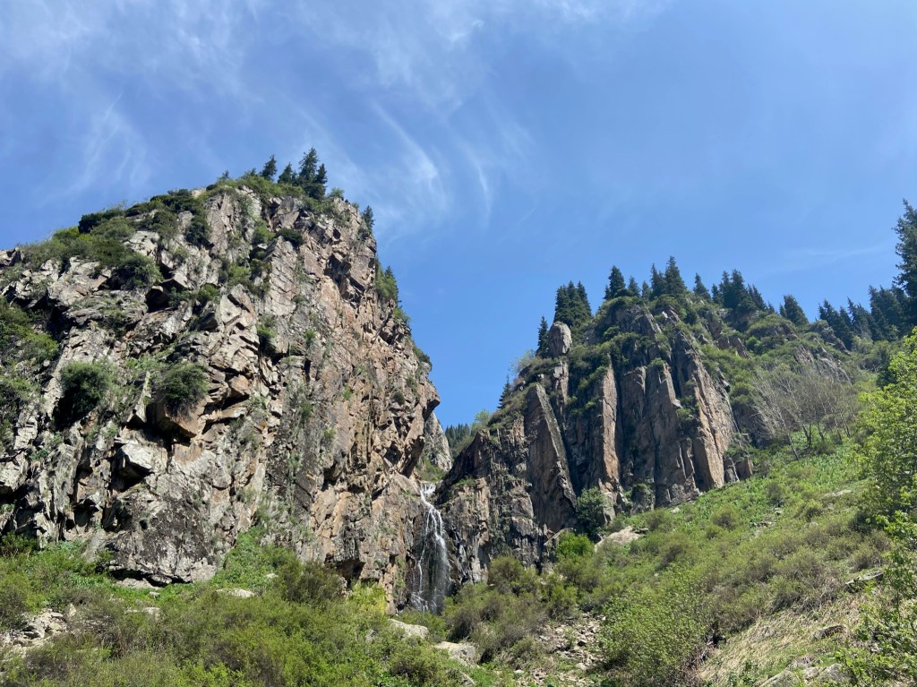
Butakovka waterfall
The Butakovka waterfall is a popular hiking area due to its proximity to Almaty. The walk in takes 30-40 minutes and is on an obvious footpath. The climbing is on granite, which is of reasonable quality, but can be crumbly and loose in some places. There are currently 19 routes at Butakovka, from 5c to 8a. The lower sector next to the waterfall will see hikers gathering for lunch and to take photos. By contrast the upper sector is quiet, being just a bit more out of the way, despite being directly above the waterfall and visible from below.
The routes at Butakovka are generally long single pitches, some of them are up to 40 meters. Because some of the rock can be loose, it is worth bearing in mind that people might be sitting at the bottom in the ‘firing line’. At weekends in particular it can be busy, so take extra care not to dislodge rock onto people standing below. It follows that belayers should always wear a helmet. Not at butakovka, but we have experienced a rock coming down that appeared to have been thrown by someone. It probably isn’t an issue here, but as people can hike to the top it is something to keep in mind.
Butakovka is not far from Medeo and gives you options for climbing in the area other than Tuyuk-Su and the village crags. In our opinion the climbing at Tuyuk-Su is better than at Butakovka, although Butakovka is easier to get to and isn’t as exposed to the weather. Butakovka is definitely worth a visit, it is an awesome place to climb with the mountain views and the sound of the waterfall in the background.
Climbing Areas We Missed
Bektau-Ata is a beautiful and unusual mountain, some 700km from Almaty. Bektau-Ata is famed for its stunning granite formations and climbers have developed a number of boulder problems as well as a few trad lines. The pictures of The rock there reminded us of Prilep, a fantastic bouldering area in North Macedonia. We were sad not to visit, but the 11 hour drive (one way!) was enough to put us off on this trip. However, it is roughly half way between Almaty and Astana, which would make it a perfect place to stop for a few days if making that journey overland. You can read more about the climbing at Bektau-Ata and find topos on Kirill’s website here.
Ust-Kamenogorsk is a city in eastern Kazakhstan and you can find a handful of routes close to the city itself. Nearby there are 11 other routes some 50 km south. The climbing here isn’t included in the digital guidebook and it is best to ask local climbers for information if you want to climb here.
Borovoye is around 250km north of Astana and is a popular area for outdoor activities. There are some beautiful rock formations in the area, and on some of them climbing is restricted so check this before you climb. Otherwise, there are around 15 routes as well as lakes and forests in the surrounding area.
As above, using Kirill’s website or contacting him is the best way to find out about climbing in Kazakhstan. Everybody we spoke to was very friendly and happy to help us and give recommendations for our trip.
If you find our content useful please consider subscribing:
Hiking Recommendations
Alma-Arasan Thermal Springs & Hiking
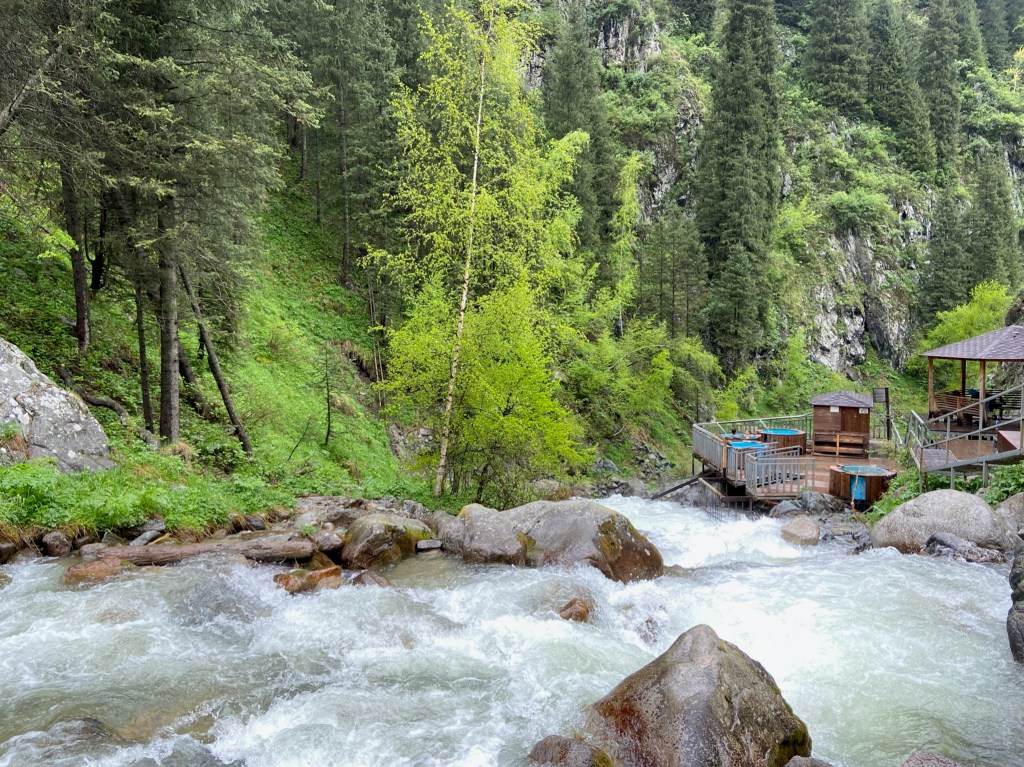
The Alma-Arasan thermal springs are a great way to spend a rest day in the Almaty area. The springs are free and are situated in a beautiful valley. One of the best features is a cage that goes into the raging river that allows you to take an icy plunge without being swept away. The water temperature is reasonably good, somewhere around 25°c. There are 3 hot tubs, 1 cold tub and a hot shower coming straight from the source. The only real downside of the place is that the tubs have suffered from exposure to the elements and have fallen into disrepair.
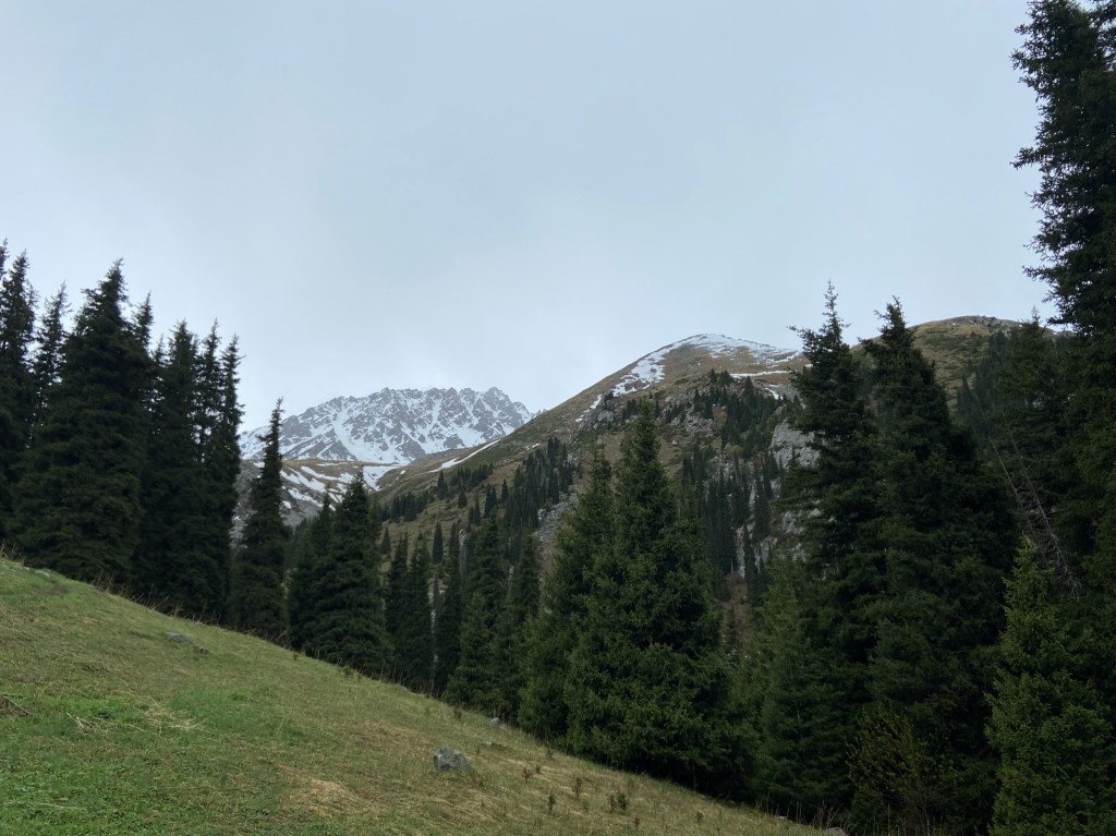
There is some lovely hiking beyond the thermal springs. There is one main footpath that leads up to an alpine meadow where there are several trails up the surrounding peaks. The thermal springs can be busy at times, but in the forest and mountains above it is perfectly calm. Although it is in a national park, camping is permitted and there are loads of awesome pitches along the river and in the meadow. Unfortunately we didn’t have any camping gear on this trip, but it would be perfect to spend a few nights camping in the meadow and get some big hill days in, making the most of your head start (the top of the meadow is just under 3000 meters elevation).
Kolsai Lakes
The Kolsai Lakes National Park is one of the most popular natural areas in Kazakhstan, widely known for its beautiful scenery. The road deposits you almost directly at the first lake, so it can be busy here at weekends. The second lake is around 9 km away and about 400 meters in elevation higher, so naturally it is always significantly quieter here. The lakes have a lovely alpine feel to them, with the lowest lake being at 1818 meters, the second at 2,252 meters, the third at 2,850 meters and the fourth higher still.

As soon as you reach the second lake the footpaths become much smaller and less worn. It appears most people stop at the start of lake for a picnic then walk back down. There is a path following the shore on the right side of the lake which then heads up the mountain visible in the photo below. You are basically guaranteed to have this place to yourself and you need sharp eyes to avoid losing the trail. It has a wonderful unspoilt feel and gives great views of the second lake and mountains towards the Kyrgyzstan border.

On the left side of the second lake, set back is a path that leads up and towards the third lake. Frustratingly, you will walk about halfway to the third lake before reaching a sign and what is seemingly some sort of guard post. The sign makes it clear you can’t go any further and the path disappears soon after. It was extremely tempting to keep going, but we had already crossed paths with the Kazakh police previously and didn’t fancy a repeat! What makes it more irksome is that the third lake is not particularly close to the border and more importantly Kazakhstan and Kyrgyzstan have strong relations and have done for a long time. There is a fourth lake that is actually close to the border and is obviously very much out of bounds.

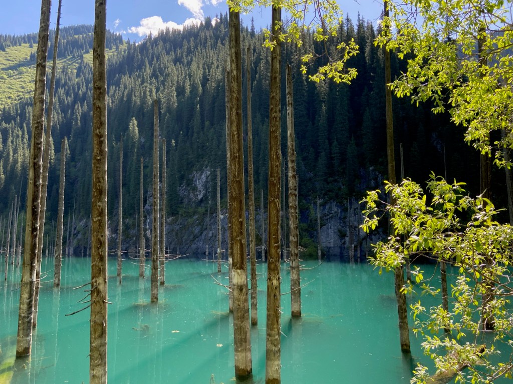
Kaindy Lake
Kaindy Lake is a unique and visually striking geological oddity, found close to Kolsai and around 300 km from Almaty. What makes Kaindy so unusual is the way it was formed. The devastating Kebin (Chon-Kemin) earthquake in 1911 caused a huge landslide to block a canyon, causing a river to flood the blocked area and form a lake. Because of the sudden formation of the lake, a forest was submerged and the trees have been preserved by the cold water and the mineral deposits it contains. The result is a truly stunning spectacle. However, the earthquake caused a lot of pain and suffering, killing 452 people and destroying over 770 buildings.
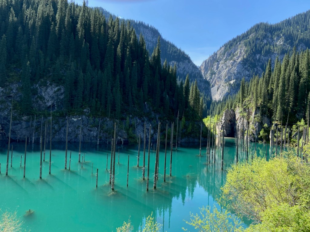
The lake is roughly 400 meters long and reaches depths of up to 30 meters. Interestingly, the lake is known for ice diving, where the very keen can scuba dive through the underwater forest after first cutting a hole in the ice. You can find some cool pictures of the ice diving here. To get to Kaindy from Saty, it is possible to walk around 13km along a dirt road, or drive there. The road is touted as an extreme 4×4 route, but in reality its not that bad. The majority is very straightforward but there are two river crossings that a standard car could fall foul of. However, we did see a brave soul that made it up in a regular sedan! If you manage to organise it, going on a mountain bike would probably be the most fun way.
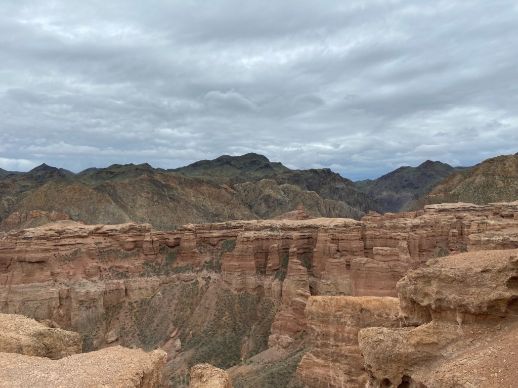
Charyn Canyon
Charyn Canyon was an obvious place to visit for a few reasons, firstly it is perfectly on route for anyone travelling between Almaty and the Kolsai area. Secondly, it is a canyon full of rocks, which is always appealing to climbers. We had rather optimistically hoped that some of the rock would be solid, but we can confirm that is is all complete choss. The canyon is popular as a hiking area that is easily accessible to beginners. The scenery is beautiful and it’s great that you are given free roam to wonder off path and get amongst it all.
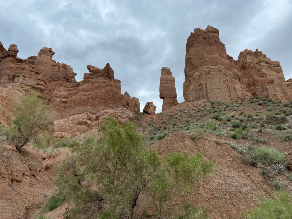
The main footpaths go through the bottom of the canyon to the river, and along one side of the canyon rim to a viewpoint. The total distance for both walks there and back is circa 10 km and if you don’t deviate from the path it should only take around 2 hours. Even with several detours up to the rocks it won’t take much longer. Although the scenery is very beautiful, we would only recommend visiting as a ‘pit stop’ on route to somewhere else. The canyon is some distance from anything else and making the journey there as the sole event of the day isn’t worth it. But it is a fantastic place to stretch the legs for a while and break up a day of travel.
Lake Issyk
This Lake Issyk is not to be confused with the much larger lake of the same name in Kyrgyzstan. This lake is near the village of Esik, not far from Turgen. Issyk falls into the same group as Charyn Canyon, in the sense that it is a very beautiful area but is best reserved as a pit stop. We hadn’t realised before we arrived that it isn’t possible to walk the circumference of the lake. Usually even if there isn’t a path it is possible with some bushwhacking. However, if you walk anti-clockwise there is a very robust and purposeful barbed wire fence to stop walkers. If you walk clockwise you can go further, around halfway around the lake and it is possible to continue up one of the valleys behind the lake. While there are still pleasant walks to be found, it isn’t worth going for a full day in its own right.

Turgen
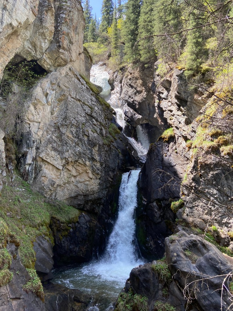
Turgen is a small village in a beautiful valley, around 100km east of Almaty. Turgen is known for hiking and recreation, but has a very different atmosphere to many comparable areas in Kazakhstan. Despite being closer to Almaty, Turgen feels less popular, less touristic and better preserved than areas like Charyn canyon or the nearby lake Issyk. There are two different waterfalls that offer pleasant short walks, the Kajrakskij waterfall and the Medvezhiy waterfall. The Kajrakskij waterfall is the longer of the two and the better hike. The valley also has a famous moss-spruce forest conservation area. The forest is full of flora and fauna and there is actually permafrost under the moss on northern aspects. At the very end of the road in the valley is the Assy-Turgen observatory. The road to reach the observatory is of poor quality so it is a better option to walk once the asphalt ends.
Kazakh cuisine
Beshbarmak is the most famous Kazakh dish and is a source of national pride. The dish consists of horse meat and giant noodles served in a broth. The noodles are roughly the size of a lasagna sheet but definitely taste like a noodle rather than pasta. Beshbarmak is the perfect traditional dish to try in Kazakhstan.
Qazy is a sausage made from horse meat. The rib meat and fat is used to create the sausage, which along with seasoning gives a very unique flavour. Qazy is a very authentic food and isn’t sold in supermarkets, instead you can buy it from local markets and bazaars.
Manti are dumplings filled with meat and various forms of them can be found throughout central Asia and the Caucasus. We found Kazakh Manti to be slightly different to others in the consistency of the dough and the flavourings inside.
Baursak are very simple and very delicious. They are shaped pieces of dough fried in oil. Best eaten fresh and hot, they are awesome!
Summary
Kazakhstan is a beautiful country with a lot to offer outdoor enthusiasts. The currently developed climbing is good and there is a strong and ever growing scene of local climbers. The amount of mountains and rock in Kazakhstan is very impressive and no doubt route development will still be expanding. Outside of climbing the culture is very interesting and it was a pleasure to experience for ourselves, particularly in rural areas where people are very kind and welcoming. Currently, Kazakhstan has minimal tourist infrastructure so be aware that B&Bs, guesthouses, restaurants etc are not always easy to find, especially in climbing areas. To avoid hungry or uncomfortable nights, plan ahead or bring your own stuff with you.
We write for pleasure and climbing is our passion. Our articles will never be paywalled. However, if you would like to help towards the costs of running the site or if you have found our content useful please consider contributing here. To read more about why your support matters, click here.
Relevant links and resources
Topos and information about the rock climbing in Kazakhstan
https://www.dropbox.com/s/3zby60dectex782/Гайд%20по%20скалам%201.6.pdf?dl=0
Information about Tamgaly-Tas
https://caravanistan.com/kazakhstan/almaty-region/ili-river/

Fantastic article, and superb pics 🙂
LikeLiked by 1 person
Hi, thank you for your comment. Glad to hear you enjoyed the article 🙂
LikeLike
Hi! Where did you guys stay when climbing in the crags nearby Medeo?
LikeLike
Hi Tyler, we stayed in the Edelveis Hotel as it was the cheapest/closest place we could find, the place was good and did the job fine. It is pretty easy to get to and from the crags up at Tuyuk-Su if you don’t have a tent, which we didn’t on that trip.We hope you enjoy Kazakhstan, it is a beautiful country, happy climbing!
Here is a link to the hotel:
https://www.google.com/maps/place/Edelveis+Hotel/@43.1648578,77.0096925,12.32z/data=!4m9!3m8!1s0x38837ae6d5f53b15:0x66b290a7c1103dad!5m2!4m1!1i2!8m2!3d43.1713876!4d77.0378481!16s%2Fg%2F11cny17rb6?entry=ttu&g_ep=EgoyMDI1MDIwOS4wIKXMDSoASAFQAw%3D%3D
LikeLike